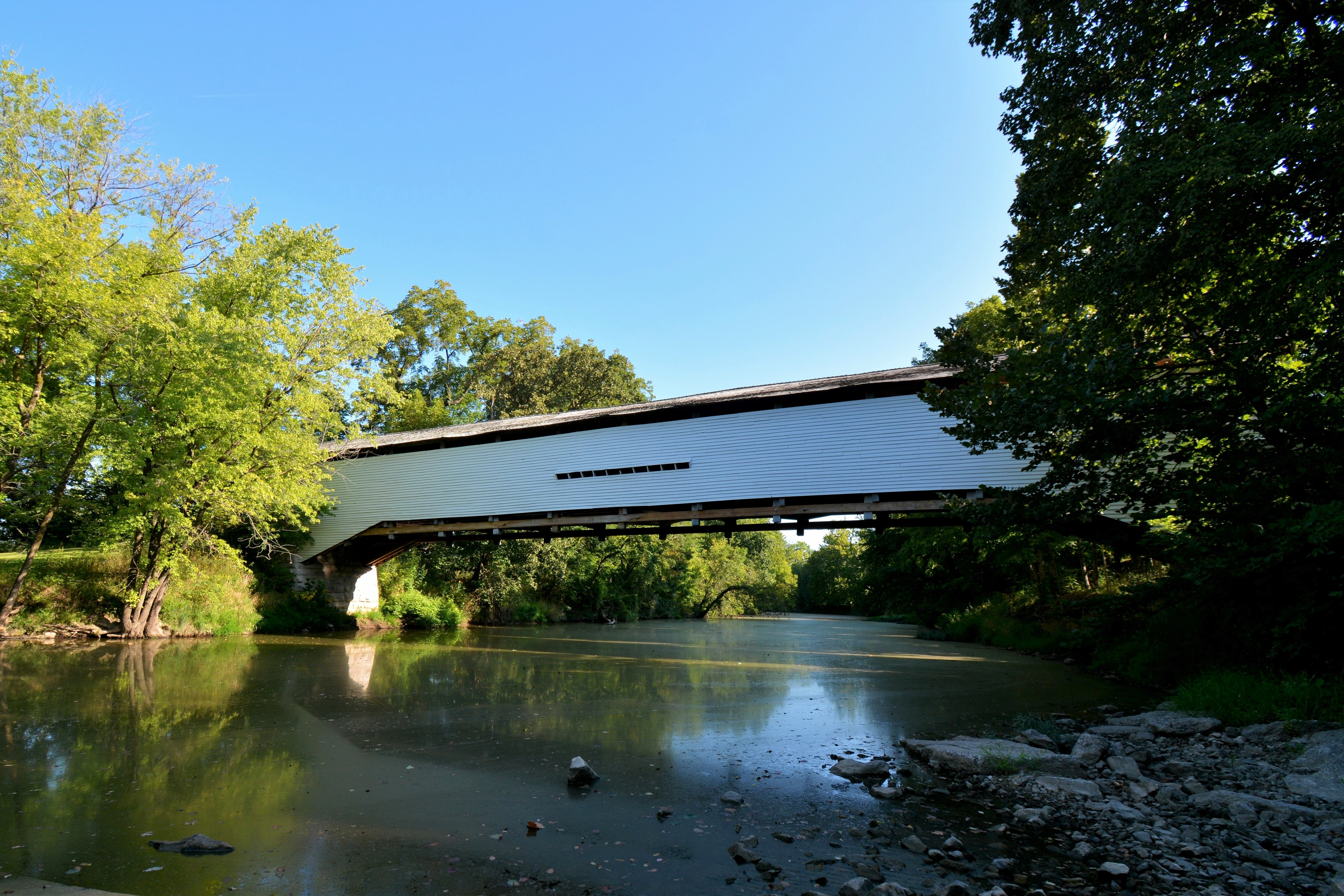
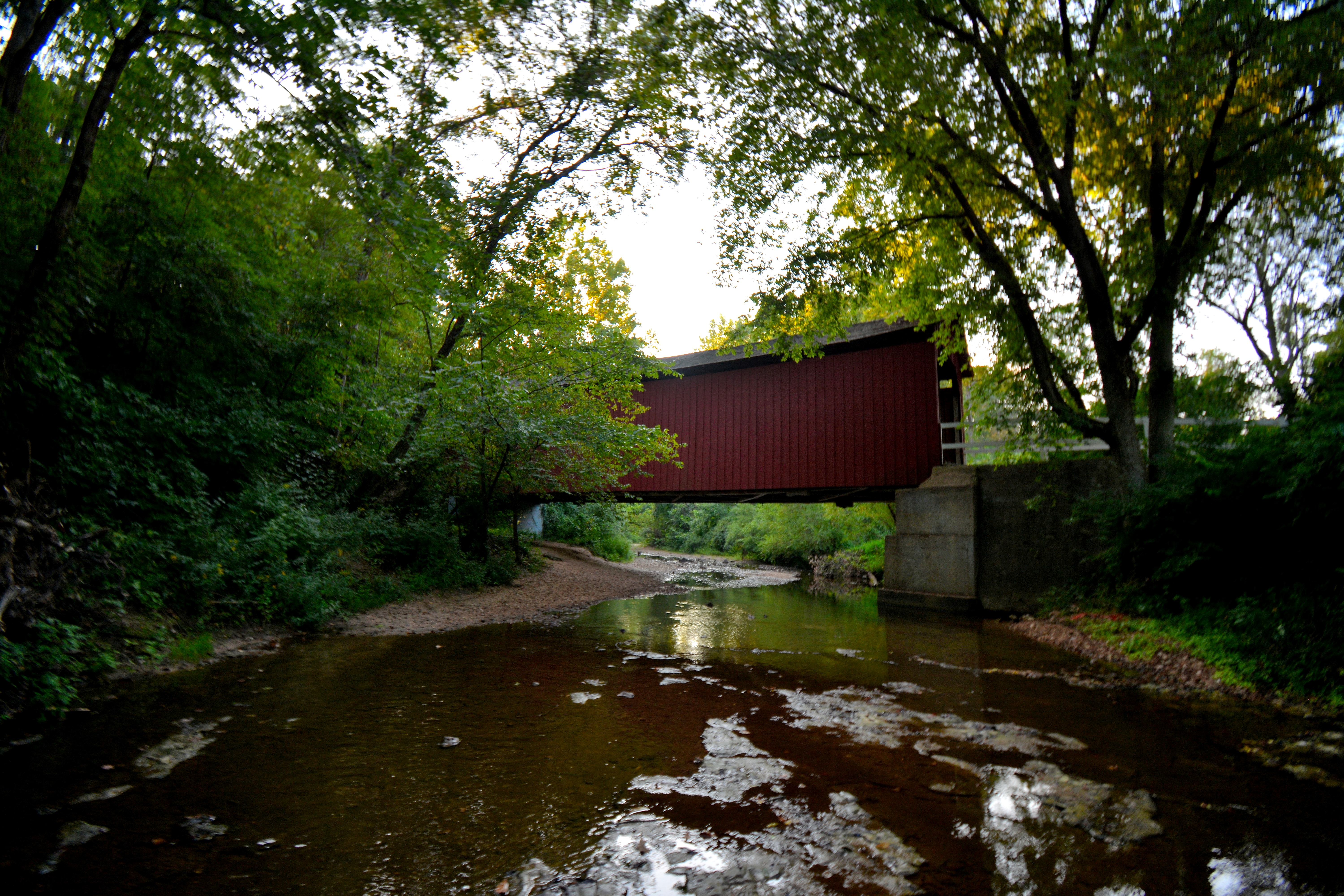
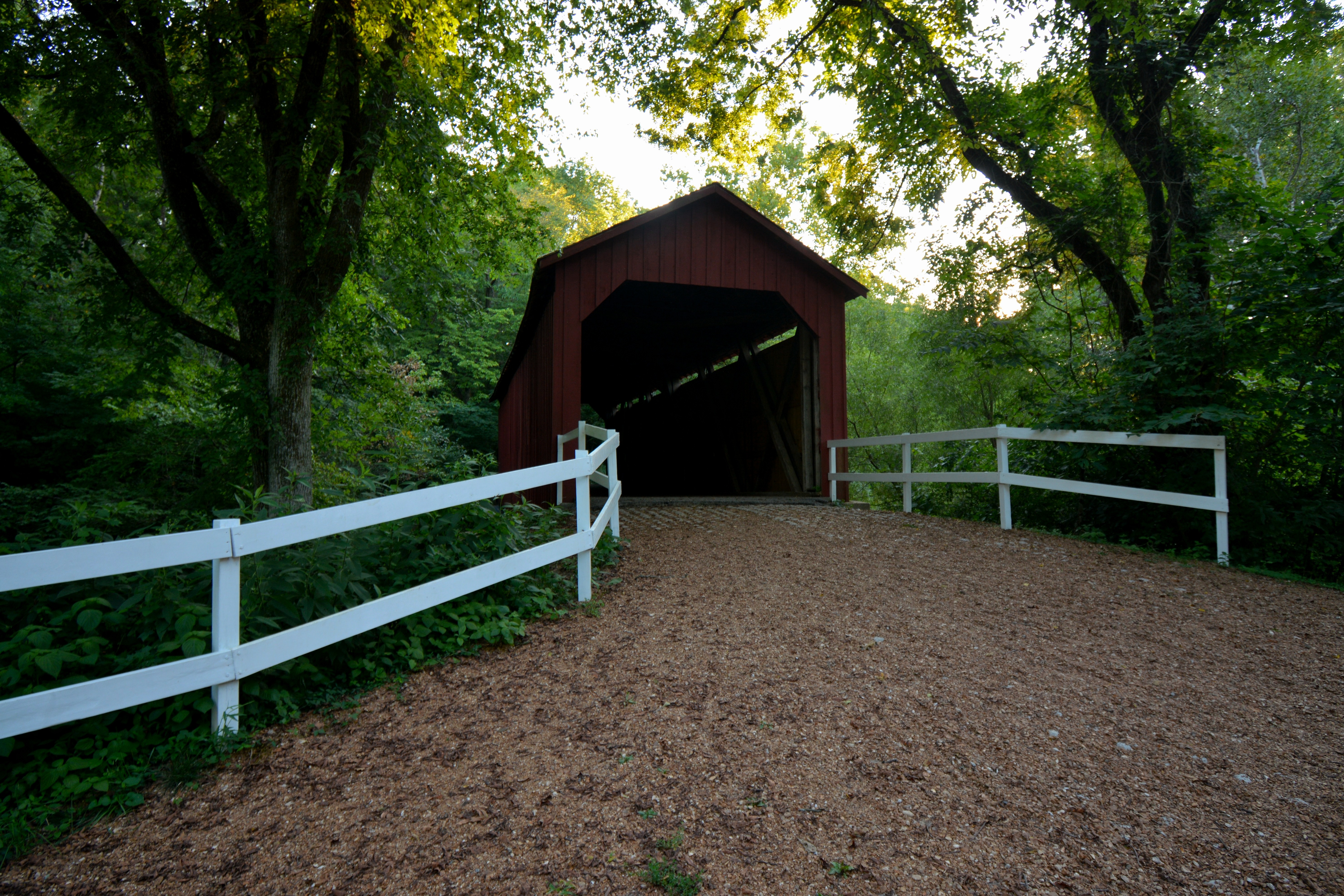
Wednesday, September 7, 2022

SANDY CREEK COVERED BRIDGE - HILLSBORO, MISSOURI


 SANDY CREEK
JEFFERSON COUNTY
BUILT - 1872

Length - 75' ... In Goldman, Central Township. MO21 N. 4.9 miles from Hillsboro, E. on Goldman Spur Rd. 0.4 miles (to T), S. on Old LeMay Ferry Rd. 0.3 miles to the bridge in a park. Built by John H. Morse of the House Springs Big River Valley Macadamized & Gravel Road Company for $2000. The bridge was heavily damaged by high water in 1886, and was rebuilt for $899 by Henry Steffin using half of the original timbers and the original abutments. The bridge came under the protection of the state parks system when the state legislature passed an act in 1967 declaring all remaining covered bridges in the state to be state historic sites. Jefferson County released the bridge to the state in 1968; a major restoration project returned the bridge to its original appearance in 1984. Renovated in 2013. Posted to the National Register of Historic Places on July 8, 1970. Closed to motor traffic. Truss Type - Covered Howe Through Truss
World Guide to Covered Bridge Number - 25-50-01

GPS +38.29406, -90.52637

Tuesday, September 6, 2022

TOTAL COVERED BRIDGES (343)

BURFORDVILLE/BOLLINGER MILL COVERED BRIDGE - BURFORDVILLE, MISSOURI


 UPPER WHITEWATER CREEK
CAPE GIRARDEAU COUNTY
BUILT - 1858-1867

Length - 140' ... In Burfordville. At the E. end of town in a park. Built by Joseph Lansmon. Construction began on the bridge in 1858, but was delayed several years by the Civil War. Bridge was built to be part of the Macadamized Road Company and used as a toll bridge. This road and bridge became a vital link, especially to farmers driving wagonloads of grain destined for the mill. The toll-road system between Burfordville, Jackson, and Cape Girardeau continued to operate as a private business with a toll booth at the end of the bridge until 1906. Bridge became obsolete by new bridges on Missouri State Route 34. Bridge rehabilitated in 1908, 1950, 1998. Posted to the National Register of Historic Places on May 19, 1970. Closed to motor traffic. Truss Type - Covered Howe Through Truss.
World Guide to Covered Bridge Number - 25-16-01

GPS +37,36835, -89.80245


BOLLINGER MILL
BUILT - 1867

After the Civil War, the George Bollinger family, (owners of the former mill that was burned down by the Union Army in order to prevent the supply of flour and meal to the Confederate Army) sold the mill ruins and 640 acres to Solomon R. Burford in 1866. Burford  built a new mill on the site of the existing 1825 foundation. This four-story, stone and brick structure is the mill that continues to stand today. Solomon Burford continued to own the mill until 1897, then he sold it to the Cape County Milling Company, which operated the mill until 1953 when it was sold to the Vandivort family, relatives of George Bollinger, the man who built the original mill on the premises. The mill operated until 1942 and was dismantled in 1953. The mill was donated to the Cape Girardeau County Historical Society in 1961 and to the State of  Missouri in 1967.   Posted to the National Register of Historic Places on May 27, 1971.

Monday, September 5, 2022

UNION COVERED BRIDGE - PARIS, MISSOURI


 ELK FORK SALT RIVER
MONROE COUNTY
BUILT - 1871

Length - 120' .... SW Paris, Jackson Township. US24 W. 6.0 miles from jct with MO15 on the N. side of Paris, S. on CR C 3.4 miles, W. on SR C Spur 0.3 miles to the bridge on the S. side of the road. Built by Joseph C. Elliott of Payson, Illinois for a sum of $5500.  Named after the nearby Union Church. Damaged by flood in 1967, was later repaired using salvaged timbers from the nearby Mexico Covered Bridge, which had been destroyed in the same flood. Closed to traffic in 1970. Rehabilitated in 1987-1988, restored in 2019. Posted to the National Register of Historic Places on June 15, 1970. Closed to motor traffic. Truss Type - Covered Double Burr Arch Through Truss.
World Guide to Covered Bridge Number - 25-69-02

GPS +39.43283, -92.10247