Showing posts with label -73.17750. Show all posts
Showing posts with label -73.17750. Show all posts
Sunday, December 15, 2019
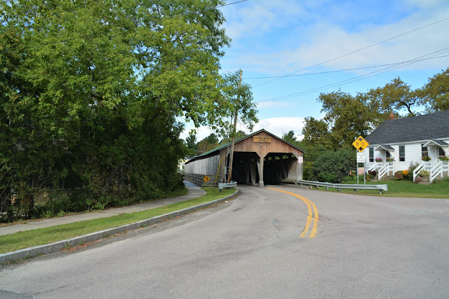
PULP MILL COVERED BRIDGE - MIDDLEBURY, VERMONT
OTTER CREEK
ADDISON COUNTY
BUILT - 1853
Length - 199'.... NW edge of Middlebury. Seymour St. N. ,03 miles from jct with US Rt.-7 in Middlebury, W.on Seymour St. 350', N. on Seymour St. .05 miles, W. on Pulp Mill Bridge Rd. 50' to bridge. The bridge is of Burr Arch design. Around 1860, the original Burr Arches were removed, and laminated ones added to King Post Trusses, changing the bridge type to a King Post with Burr Arch Design. The bridge was originally built as a single span but inherent design problems, and heavy use, has driven almost constant improvements. Amongst those improvements was the addition of two piers in the creek effectively dividing the bridge into 3 spans. A non-structural improvement was the addition of a walkway on the outside of the bridge. Piers added 1979; rehabilitated in 1991, and again in 2012. Posted to the National Register of Historic Places on September 10, 1974. Open to through traffic. Truss Type - Double-Barreled Burr Arch with additional arched added.
World Guide to Covered Bridge Number - 45-01-04
Subscribe to:
Posts (Atom)


