RIVER - OTTER CREEK
RUTLAND COUNTY
BUILT - 1840
Length - 121'....
WNW of Pittsford, Pittsford Township. Depot Hill Rd. W. (curves N. & back W.) 0.8 miles from jct with US7 in Pittsford to the bridge. Builder was Abraham Owen. Bridge underwent restoration in 1974, at which time the abutments were faced in concrete, and in 2006 its deck was supported by steel stringers. It was placed on The National Register of Historic Places on January 24, 1974. Open to through traffic. Truss Type - Covered Town Lattice Through Truss.
World Guide to Covered Bridge Number - 45-11-06
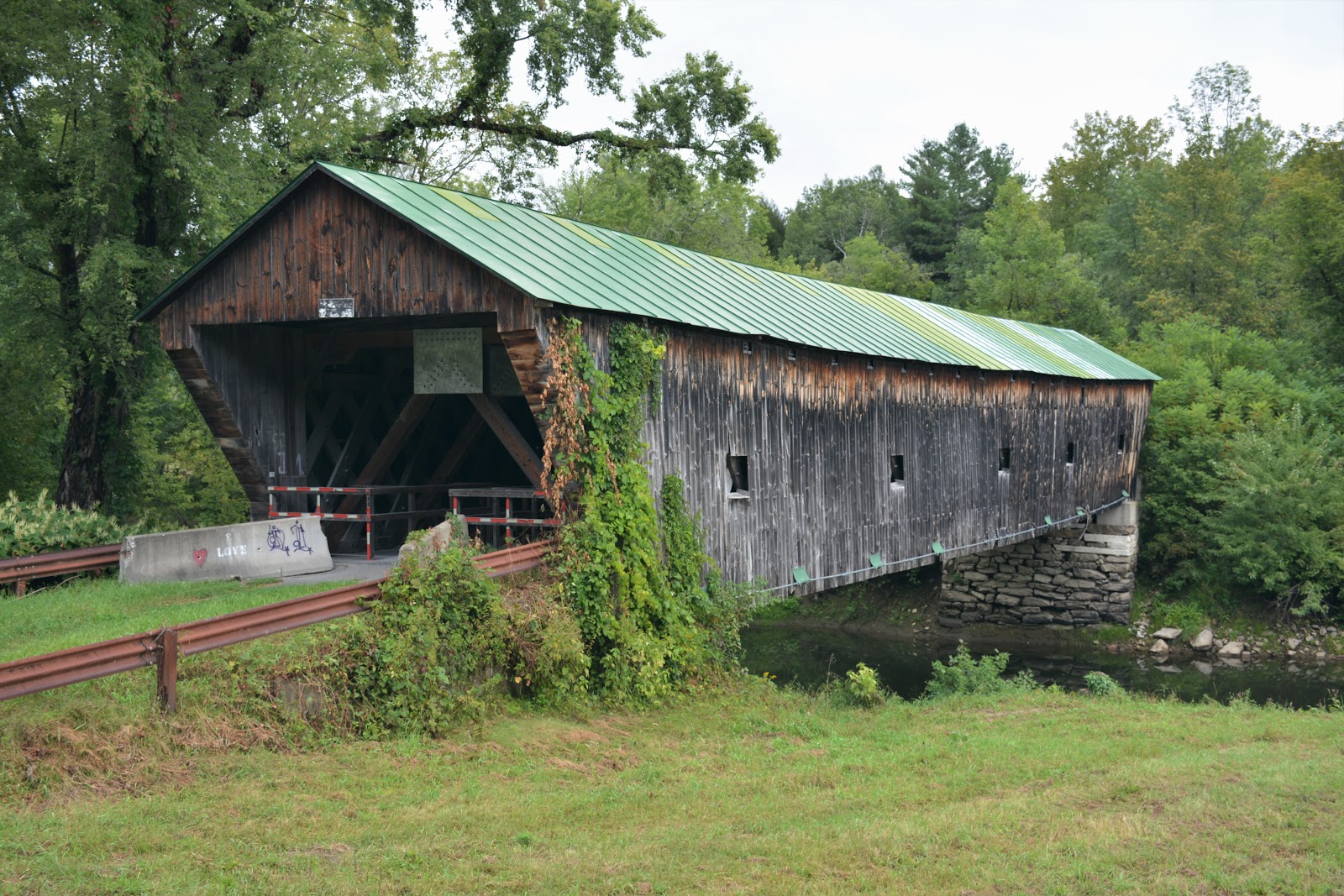
RIVER - OTTER CREEK
RUTLAND COUNTY
BUILT - 1842
Length - 139'....
NW of Pittsford, Pittsford Township. US7 N. 1.1 miles from jct with Mill St. in Pittsford, W. on Kendall Hill Rd. 0.7 miles to the bridge on the N. side of the road. Closed to motor traffic. The bridge was built in 1842 by Asa Nourse. In 1927, a flood swept the bridge 1.5 miles downstream but left the structure mostly intact. Since it was functional, the bridge was placed on barrels and transported back to its original location. Placed on the National Register of Historic Places on January 21, 1974. Closed to through traffic. Truss Type - Covered Single Span Town Through Lattice, the bridge has been reinforced with laminated beams mounted below the trusses.
World Guide to Covered Bridge Number - 45-11-05
OTTER CREEK
RUTLAND COUNTY
BUILT - 1838
Length - 131'.... W. of Brandon, Brandon Township. Pearl St. SW 1.3 miles from jct with US7/VT73 in Brandon to the bridge. Rehabilitated in 2003. Listed on the National Register of Historic Places in 1974. Open to through traffic. Truss Type - Covered Single Span Town Lattice with laminated beams attached to the underside of the structure for added strength.
World Guide to Covered Bridge Number - 45-11-02
LEMON FAIR RIVER
ADDISON COUNTY
BUILT - 1897
Length - 108'.... On abandoned RR line W. of Whiting, Shoreham Township. Shoreham Whiting Rd. (changes to Richville Rd.) W. 2.8 miles from jct with VT73 E. in Whiting, S. on East Shoreham Rd. 0.7 miles to the bridge on the W. side of the road. The bridge was built in 1897 by the Rutland Railroad Company for service on its Addison Branch line. Because of the line's relatively light traffic, it was not judged necessary to go to the expense of building an iron bridge, resulting in the construction of one of the state's few surviving 19th-century covered railroad bridges. The bridge was last used for rail traffic in 1951. The railroad tracks have been removed and replaced with a plank walkway. The bridge was renovated in 1983 with new siding and a new roof. Rehabilitated in 2007. Placed on the National Register of Historic Places on June 13, 1974. Truss Type - Covered Single Span Howe Truss.
World Guide to Covered Bridge Number - 45-01-05
OTTER CREEK
ADDISON COUNTY
BUILT - 1853
Length - 199'.... NW edge of Middlebury. Seymour St. N. ,03 miles from jct with US Rt.-7 in Middlebury, W.on Seymour St. 350', N. on Seymour St. .05 miles, W. on Pulp Mill Bridge Rd. 50' to bridge. The bridge is of Burr Arch design. Around 1860, the original Burr Arches were removed, and laminated ones added to King Post Trusses, changing the bridge type to a King Post with Burr Arch Design. The bridge was originally built as a single span but inherent design problems, and heavy use, has driven almost constant improvements. Amongst those improvements was the addition of two piers in the creek effectively dividing the bridge into 3 spans. A non-structural improvement was the addition of a walkway on the outside of the bridge. Piers added 1979; rehabilitated in 1991, and again in 2012. Posted to the National Register of Historic Places on September 10, 1974. Open to through traffic. Truss Type - Double-Barreled Burr Arch with additional arched added.
World Guide to Covered Bridge Number - 45-01-04